-
World Atlas of Coffee
James Hoffmann
Hardcover (Mitchell Beazley, Oct. 6, 2014)Coffee has never been better, or more interesting, than it is today. Coffee producers have access to more varieties and techniques than ever before and we, as consumers, can share in that expertise to make sure the coffee we drink is the best we can find. Where coffee comes from, how it was harvested, the roasting process and the water used to make the brew are just a few of the factors that influence the taste of what we drink. Champion barista and coffee roaster James Hoffmann examines these key factors, looking at varieties of coffee, the influence of terroir, how it is harvested and processed, the roasting methods used, through to the way in which the beans are brewed. Country by country - from Bolivia to Zambia - he then identifies key characteristics and the methods that determine the quality of that country's output. Along the way we learn about everything from the development of the espresso machine, to why strength guides on supermarket coffee are really not good news. This is the first book to chart the coffee production of over 35 countries, encompassing knowledge never previously published outside the coffee industry. For everyone who wants to understand more about coffee and its wonderful nuances and possibilities, this is the book to have.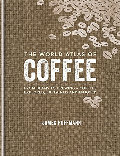
-
Atlas of the World
Oxford University Press
Hardcover (Oxford University Press, Nov. 4, 2004)Eleven years ago, the first edition of Oxford's Atlas of the World was met with praise for the incredible beauty and accuracy of its maps as well as for its wealth of geographic data, and each successive edition only collects more accolades. The New York Times Book Review called it a "veritable encyclopedia of geographic and demographic information, profusely illustrated with multicolored maps and graphs," and the Baltimore Sun exclaimed that the newest edition was nothing less than "a magnificently produced example of quality publishing." Replete with 67 maps of cities worldwide, the 12th edition charts the key urban centers of each continent from Athens, Greece (including its new airport) to Wellington, New Zealand. As in past editions, the Atlas has been completely updated to reflect the changing world around us. Refined name forms in Malaysia and South Africa, the addition of a new state in Indonesia, extra name detail in the Atlantic and the Pacific Oceans and dozens of other improvements make this the most reliable atlas on the market. The unique Gazetteer of Countries adds a yet another quick reference tool to a book already teeming with useful information. Several new features further enhance the 12th edition. Interstate and state highways are now shown throughout North America, putting the overall precision and clarity of the book well ahead of the competition. A Glossary of Geographical Terms will be an enormous asset to those unfamiliar with foreign terminology while the colorful Introduction to World Geography--redesigned and beautifully illustrated with tables and graphs--provides informative summaries of topics as diverse as climate, global warming, plate tectonics, international conflicts, agriculture, trade, and population. What's more, detailed explanatory captions accompany the section of full-page satellite images that Library Journal called "stunning." Offering the finest global coverage available, the Atlas of the World sets the standard in atlas quality, living up to its reputation as an "indispensable reference," granted by NBC's Weekend Today Show.
-
Atlas of the World
Oxford University Press
Hardcover (Oxford University Press, Oct. 1, 2016)The only world atlas updated annually, guaranteeing that users will find the most current geographic information, Oxford's Atlas of the World is the most authoritative atlas on the market. Full of crisp, clear cartography of urban areas and virtually uninhabited landscapes around the globe, the Atlas is filled with maps of cities and regions at carefully selected scales that give a striking view of the Earth's surface. It opens with a fascinating look at world statistics and 18 pages of stunning satellite images, all sourced from NASA's latest Earth Observation Satellite, Landsat 8. The extraordinarily extensive front matter continues with a "Gazetteer of Nations" that has been comprehensively checked and updated to include recent economic and political changes, and a 48-page "Introduction to World Geography," beautifully illustrated with tables and graphs on numerous topics of geographic significance, such as the geology and atmosphere of Earth, food and water supply, biodiversity, energy, global conflict, human health, and standards of living. The hundreds of city and world maps that form the body of the Atlas have been thoroughly updated for this 23rd edition.Providing the finest global coverage available, the Atlas of the World is not only the best-selling volume of its size and price, but also the benchmark by which all other atlases are measured.
-
Atlas of the World
Oxford University Press
Hardcover (Oxford University Press, Nov. 1, 2017)The only world atlas updated annually, guaranteeing that users will find the most current geographic information, Oxford's Atlas of the World is the most authoritative atlas on the market. Full of crisp, clear cartography of urban areas and virtually uninhabited landscapes around the globe, the Atlas is filled with maps of cities and regions at carefully selected scales that give a striking view of the Earth's surface. It opens with a fascinating look at world statistics, a six-page special on "Land and Maritime Boudaries," and satellite images of earth, including 8-10 stunning new images sourced from NASA's latest Earth Observation Satellite, Landsat 8, launched in 2013. The extraordinarily extensive front matter continues with a "Gazetteer of Nations" that has been comprehensively checked and updated to include recent economic and political changes, and a 48-page "Introduction to World Geography," beautifully illustrated with tables and graphs on numerous topics of geographic significance, such as climate change, world religions, employment, industry, tourism, and travel. The hundreds of city and world maps that form the body of the Atlas have been thoroughly updated for this 24th edition.Providing the finest global coverage available, the Atlas of the World is not only the best-selling volume of its size and price, but also the benchmark by which all other atlases are measured.
-
Atlas of the World
Oxford University Press
Hardcover (Oxford University Press, Oct. 1, 2014)The only world atlas updated annually, guaranteeing that users will find the most current geographic information, Oxford's Atlas of the World is the most authoritative atlas on the market. Full of crisp, clear cartography of urban areas and virtually uninhabited landscapes around the globe, the Atlas is filled with maps of cities and regions at carefully selected scales that give a striking view of the Earth's surface. It opens with a fascinating look at world statistics, a six-page special on "The Future of the Oceans and Seas," and satellite images of earth, including eleven stunning new images sourced from NASA's latest Earth Observation Satellite, Landsat 8, launched in 2013. The extraordinarily extensive front matter continues with a "Gazetteer of Nations" that has been comprehensively checked and updated to include recent economic and political changes, and a 48-page "Introduction to World Geography," beautifully illustrated with tables and graphs on numerous topics of geographic significance, such as the geology and atmosphere of Earth, food and water supply, biodiversity, energy, global conflict, human health, and standards of living. The hundreds of city and world maps that form the body of the Atlas have been thoroughly updated for this 21st edition.Providing the finest global coverage available, the Atlas of the World is not only the best-selling volume of its size and price, but also the benchmark by which all other atlases are measured.New to this Edition:� Eleven stunning new satellite images, all sourced from NASA's latest Earth Observation Satellite, Landsat 8, launched in 2013� Fact panels, flags and text comprehensively checked and updated to include recent economic and political changes� Climate Change and Global Warming spread updated in line with findings from the Intergovernmental Panel on Climate Change� Updates to the depiction of the borders between Crimea and Ukraine, and between Crimea and Russia� Politically-colored maps of Crimea show disputed borders� New graphics on rising sea-levels and Arctic sea ice� New feature on the value of ecosystems� Adds museums; Hermitage, Spaarpotten, and Allard Pierson in Amsterdam, Bangkok Art and Culture Centre, Neues Museum in Berlin, Gulbenkian Museum in Lisbon, Design Museum and Saatchi Gallery in London, and the P�rez Art Museum in Miami� Adds new subway stations in Beijing, Budapest, and Delhi� Adds light railway in Jerusalem and tram route in Edinburgh� Renames Budapest International Airport� Shows changes to street names in Cape Town (eg Nelson Mandela Boulevard)� Adds new road tunnel in Istanbul joining Asia and Europe� Adds new suburb name Hudson Yards and High Line elevated garden in New York� Adds extra suburb names to Atlanta, Seoul, and Toronto� Shows new suburbs and areas of reclaimed land to Singapore� Shows Hornindalsvatnet in Norway, Europe's deepest lake� Adds new national parks; Sierra de Guadarrama in Spain, Gallipoli in Turkey, and Kumbhalgarh in Rajasthan, India� Shows reduced extent of Lake Urmia in Iran and Lake Razzaza in Iraq� Shows major new rail links between Iran and Kazakhstan and between Iran and Azerbaijan� Adds the world's most northerly railway line in the Yamal Peninsula, Russia� Adds Longtan Reservoir in Southern China and Tekeze Reservoir in Ethiopia� Shows new provinces; Monza and Brianza in Northern Italy, Davao Occidental in the Philippines, Kalimantan Utara in Indonesia, Rangpur in Bangladesh, Alborz in Iran, and Jiwaka and Hela in Papua New Guinea� Adds major new ports; Ambarli in Turkey, Songdo in South Korea, Laem Chabang in Thailand, Johor Port in Malaysia, Ra's Al Khair in Saudi Arabia, Morgan's Port in Texas, and Itaguai near Rio de Janeiro� Names new cities Iskandar, Malaysia and Masdar City, near Abu Dhabi� Adds new resorts in Southwest Burma - Chaungtha and Ngwesaung� Shows Telangana in regional type, pending ratification of statehood by Indian Congress� Adds new high speed rail lines under construction between Tel Aviv and Jerusalem, and between Rio de Janeiro and Sao Paulo� Shows rail under construction between Kaduna and Abuja, Nigeria� Shows new administrative subdivisions in Oman, Kenya, Tanzania, Namibia, and Madagascar� Shows major ore exporting ports; Cape Lambert in Western Australia and Puerto Bolivar in Colombia� Shows new heights for Aoraki Mount Cook and Mount McKinley (Denali)� Names world's largest extinct volcano the Tamu Massif, Northwest Pacific� Adds regional names Kitikmeot, Kivalliq, Nunavik, and Nunatsiavut in Northern Canada� Shows Algodones Dunes in Southern California
-
Atlas of the World
Oxford University Press
Hardcover (Oxford University Press, Oct. 1, 2009)The only world atlas updated annually, guaranteeing that users will find the most current geographic information, Oxford's Atlas of the World is the most authoritative resource on the market. The Sixteenth Edition remains the finest international reference source of its kind available. Including new census information, dozens of city maps, gorgeous satellite images of Earth, and a geographical glossary, this atlas offers exceptional value at a reasonable price. Full of crisp, clear cartography of urban areas and virtually uninhabited landscapes around the globe, the Atlas has maps of 69 cities and nearly 100 different regions at carefully selected scales that give a striking view of the Earth's surface. Opening with world statistics and a colorful, instructive 48-page Introduction to World Geography--beautifully illustrated with tables and graphs--this acclaimed resource provides details on such topics as climate, the greenhouse effect, plate tectonics, agriculture, population and migration, and global conflicts. As in years past, this edition includes the latest geographic information. The popular satellite image section has been refreshed with stunning new images of different regions and urban areas. A completely updated Gazetteer of Nations provides an invaluable A-Z reference of concise country profiles, including statistics on economies, politics, and historical profiles. Providing the finest global coverage available, the Atlas of the World is not only the best-selling volume of its size and price, but also the benchmark by which all other atlases are measured. · Interior pages designed for heightened accuracy and ease of use · Detailed city plans and country profiles make it the ultimate geographic reference The Design Oxford's Atlas of the World is a sturdy, high-quality, large-format book that is filled with crisp cartography, spectacular satellite imagery, and a wealth of information on changing conditions around the planet. The Special Sections Oxford's Atlas of the World provides an extensive intro to World Geography, up-to-date information on current events of geographical significance, captioned satellite images of the Earth, facts and figures on every sovereign state, and detailed coverage of 69 major urban areas. The Quality of Information Oxford's Atlas of the World is the only world atlas that is updated annually, guaranteeing that users will find the most current geographic information. It is the most authoritative resource on the market and offers the most current global information available today through a combination of statistics, maps, and photographs. The History Oxford University Press is known around the world for excellence, tradition, and innovation. The Atlas of the World is the best-selling volume of its size and price and the esteemed benchmark by which all other atlases are measured. The Price You receive a lavish, top-quality product at an excellent price that is comparable or lower than the main competitors.
-
Atlas of the World
Keith Lye, Philip Steele
Hardcover (Parragon Publishing, Jan. 1, 2004)This book is packed with facts and provides an exciting journey in which young readers can explore for themselves the world and its people. Each region is examined in depth, showing it position on the globe and its terrain and landscape. Fact boxes contain important information such as capitol city, population, and language. The history pages give a valuable timeline of the important events in each country s past. The Atlas of the World is an indispensable source of reference for every family. · Color illustrations &photography throughout · Locator globes & flags for every country · Comprehensive index U
U
-
Atlas of the World
Oxford
Hardcover (Oxford University Press, Oct. 15, 2008)Oxford's Atlas of the World is the most authoritative resource on the market. The Fifteenth Edition remains the finest international reference source of its kind available. Including a free world wall map in every volume, updated census information, dozens of city maps, a gazetteer of nations, gorgeous satellite images of Earth, and a geographical glossary, this atlas offers exceptional value at a reasonable price. Full of crisp, clear cartography of urban areas and virtually uninhabited landscapes around the globe, the Atlas has maps of 69 cities and nearly 100 different regions at carefully selected scales to give a striking view of the Earth's surface. Opening with world statistics and then a colorful, instructive 48-page Introduction to World Geography--beautifully illustrated with tables and graphs--this acclaimed resource provides details on such topics as climate, the greenhouse effect, plate tectonics, agriculture, population and migration, and global conflicts. As in years past, this edition includes the latest geographic information: a new flag for Iraq, the addition of the Republic of Kosovo to the map of Europe, a new region in Senegal and two provinces in the Philippines, plus the appearance of the world's newest landmass, Warming Island, revealed by the melting Greenland ice sheet. Current census statistics also help to illustrate tables showing the population of world countries and cities and the popular satellite image section has been refreshed with stunning new images of different regions and urban areas. Providing the finest global coverage available, the Atlas of the World is not only the best-selling volume of its size and price, but also the benchmark by which all other atlases are measured. *Promotional world wall map included with every copy *Interior pages designed for heightened accuracy and ease of use *Detailed city plans and country profiles make it the ultimate geographic reference "An indispensable reference." --The Today Show "A veritable encyclopedia of geographic and demographic information, profusely illustrated. Extraordinary." --The New York Times "This authoritative volume is the standard by which others will be measured." --Boston Herald "You can't do better than the Atlas of the World." --Chicago Tribune
-
Atlas Of My World
Parragon Books
Hardcover (Parragon Books, Sept. 9, 2012)The perfect introduction to childrens reference, the Discovery Kids Atlas of My World is packed with information thats easy for kids to read and to understand. Designed to help children learn about the countries around them and their culture, this photo-filled book is a beautiful addition to any first reference library.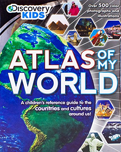 U
U
-
Atlas of the World
Not Available
Hardcover (Parragon Inc, Aug. 1, 2007)Book by Parragon P
P
-
Atlas of the World
Oxford University Press
Hardcover (Oxford University Press, Oct. 28, 2005)Positioned at the top of Oxford's atlas range, the Deluxe Edition incorporates a host of large-scale North American maps plus a substantial number of completely new topographical maps of Asia and the Pacific where international interest is increasingly focused. The New York Times Book Review called the Atlas of the World a "veritable encyclopedia of geographic and demographic information," but this new volume will do even better. Building on the strength and integrity of its smaller predecessor, the Deluxe Edition adds 33 more city maps (for a total of 100) and 102 pages of geopolitical maps (making 278 in all), to remain at the forefront of essential geographic resources. Oxford's distinctive cartographic style, combining layer-colored contours with hill shading gives an exceptionally vivid depiction of landforms and the expanded index includes geographical features, historical placenames, as well as full latitude and longitude coordinates. As always, the atlas has been fully updated to reflect the changing world around us and the opening Introduction to World Geography--designed in a fresh manner and beautifully illustrated--adds a quick reference tool to a book already teeming with useful information. Refined name forms, extra detail in maps of the oceans, more vital statistics and dozens of other improvements make this the most reliable atlas on the market. Published in a protective slip-case that is more compact than the leading competition, the Deluxe Edition makes reference easier and storage more convenient. The full-page satellite images that have generated such excitement in the past are still present, as is the popular Regions in the News feature. Plus, this volume offers expanded coverage of Mexico, Scandinavia, Israel, Lebanon, Jordan, Central Asia, Korea, Taiwan, Ethiopia, Australia and New Zealand. Plus six maps of the ocean floor mean that not one inch of the Earth's crust is overlooked. Maps of the moon aren't forgotten either and form another component in this astounding new resource. Providing the finest global coverage available, the Deluxe Edition raises the bar by which all other world atlases will be measured. Atlases come with free six-month access to Oxford Reference Online (a $119 value).
-
Atlas of the World
Not Available
Hardcover (Oxford University Press, Nov. 6, 2006)When Oxford's Atlas of the World debuted in 1992, it was widely praised for the incredible beauty and accuracy of its maps as well as for its wealth of geographic data, and it has only collected more praise with each edition since. The New York Times Book Review called it a "veritable encyclopedia of geographic and demographic information, profusely illustrated with multicolored maps and graphs," while the Baltimore Sun has declared it "a handsome, useful, inspiring thing to have." Building on the integrity of its first edition and the strong sales of the twelfth, the Atlas should remain at the forefront of essential geographic resources. Full of maps of urban areas worldwide, the 13th edition adds Orlando, Florida, Las Vegas, Nevada, and Montreal, Quebec for a total of 70 cities. As ever, the colorful 48-page "Introduction to World Geography" section-beautifully illustrated with tables and graphs-provides a wealth of information on such topics as climate, the greenhouse effect, plate tectonics, agriculture, population and migration, and global conflicts. Plus, as in past editions, the Atlas has been thoroughly updated to reflect the changing world around us. The completion of the Tibet Railway linking Tibet with the rest of China, the opening of five new international airports, the appearance of new regions in Denmark and new provinces in Rwanda, and dozens of other improvements make this the most reliable atlas on the market. The 13th edition also boasts several new features: the latest nameforms in Korea and Greece, new maps of Ethiopia, Kazakhstan, Korea, and Taiwan, as well as additional map detail in Australia showing aboriginal areas. Current census statistics produce a table showing the most up-to-date population figures for major world cities, and a redesigned index makes searching the book easier than ever. Providing the finest global coverage available, the Atlas of the World is not only the best-selling volume of its type, it has become the benchmark by which all other atlases are measured. The Chicago Sun-Times went so far as to proclaim "you can't do better than the Atlas of the World, 12th Edition," although the 13th may very well prove them wrong.